This article is more than 1 year old
Google erases British bases in Iraq
Terrorists planned attacks using Google Earth, Army says
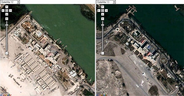
The proof comes from a handy comparison tool which offers "before and after" views by comparing current and older Google satellite imagery of the same area. Here's the Shatt al Arab camp seen in all its previously exposed glory on the left, and in the pre-war state now showing on Google Earth on the right (click on pic for a bigger view):
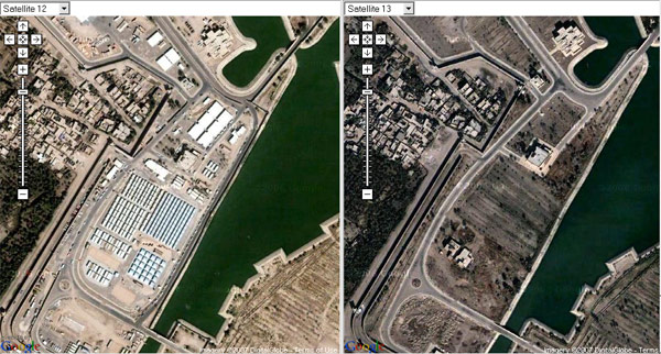
And here's a detail of Saddam's former riverside Basra Palace complex:
While it's evident the Army had a legitimate cause for complaint, the fact that the offending hi-res images are still available online, coupled with the Telegraph's revelation that print outs of the bases "are being sold to rogue militias in the market place in Basra", suggest Google's actions may have come too late.
Which will do little to calm tempers among some Army units. Soldiers from the Royal Green Jackets based at the Basra Palace base told the Telegraph "they had considered suing Google Earth if they were injured by mortar rounds that had been directed on the camp by the aerial footage".
One soldier pointed out: "Even if they did blank out the areas where we are based it is a bit after the horse has bolted as the terrorists now have the maps and know exactly where we eat, sleep, and go to the toilet." ®


