This article is more than 1 year old
Google rebuilds New Orleans
Hurricane? What hurricane?
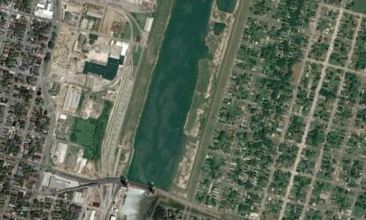
Here, however, is the same view as currently offered on Google Earth (click here to view on Google Maps):
Ceeon Quiett, spokeswoman for Mayor Ray Nagin, said that as far as she was aware, "the city did not request the map change". She said: "My first reaction was, that's a bit problematic."
Ruston Henry went further, demanding: "Is Google part of the conspiracy? Why these images of pre-Katrina? Seems mighty curious."
Chikai Ohazama, a Google product manager for satellite imagery, admitted he didn't know when the new images were uploaded and stressed he hadn't been asked "personally" to make the change. He added that "the maps now available are the best the company can offer", and explained that Google used "numerous factors" to decide what's selected for the databases - "everything from resolution, to quality, to when the actual imagery was acquired".
One local offered a plausible explanation for the transformation. Fisherman Pete Gerica, who said he'd used Google images of his flooded waterside homestead "in his arguments with insurance adjusters", offered: "I think a lot of stuff they're doing right now is smoke and mirrors because tourism is so off. It might be somebody's weird spin on things looking better." ®

