This article is more than 1 year old
Smart-map battle network for footsoldiers gets $12m demo
Covert special-ops smartphone version also offered
DC4S: At last, the phrase 'killer app' takes on some meaning

Previous versions of the no-satnav-required man tracker.
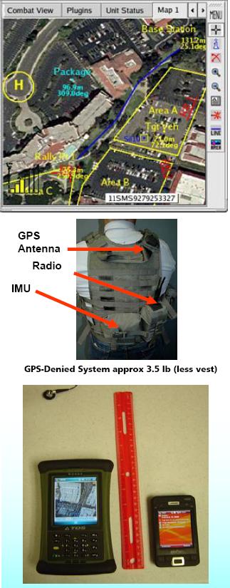
As GSE, various new things will be put onto the SwitchBack to make it suitable as an infantryman's network terminal. Specifically, Raytheon mention DC4S*, a system which lets troops keep track of each other even where there's no GPS signal - as inside a building or a tunnel complex. DC4S involves users wearing an inertial-navigation unit and computer hooked up to military communications (usually a tactical UHF data radio). Every trooper can thus see where his team-mates are, and so avoid accidentally shooting them or blowing them up. The system allows a stricken soldier to press a "man down" button, and everyone can see where he is in order to rescue him. Small-unit commanders can see where all their men are; everyone can see where airstrikes or artillery are being called in, where their team-mates have spotted enemies etc etc.
DC4S has already been extensively tested using ruggedised PDAs, UMPCs and so forth. There's even a "covert" option available, according to this company pdf, where the application runs on a Windows Mobile smartphone - so allowing a team of clandestine special-warfare operators to use DC4S while appearing merely to be making calls, checking their email etc. (Presumably in this case the concealed inertial-nav unit would connect to the handset via Bluetooth, and the data might be carried on cellular channels rather than military UHF.)
A DC4S troop-net can also connect to other things - gunshot detectors, unmanned ground and air vehicles (with "near streaming video"), laser/compass target locator scopes which can mark an enemy's location exactly on the networked map as soon as he's spotted.
